Travel
Christmas snow map update: States expecting worst travel conditions

What’s New
With Christmas less than a week away, meteorologists have a good idea what kind of weather will impact different parts of the U.S. in the days leading up to the holiday.
Why It Matters
With 107 million Americans traveling by car and nearly 8 million flying, the American Automobile Association (AAA) expects a record-breaking holiday travel season. Winter weather is expected to impact both modes of travel, and either rain or snow will span much of the U.S. in the days leading up to Christmas as travel begins to pick up.
Thinkstock Images/Getty
What To Know
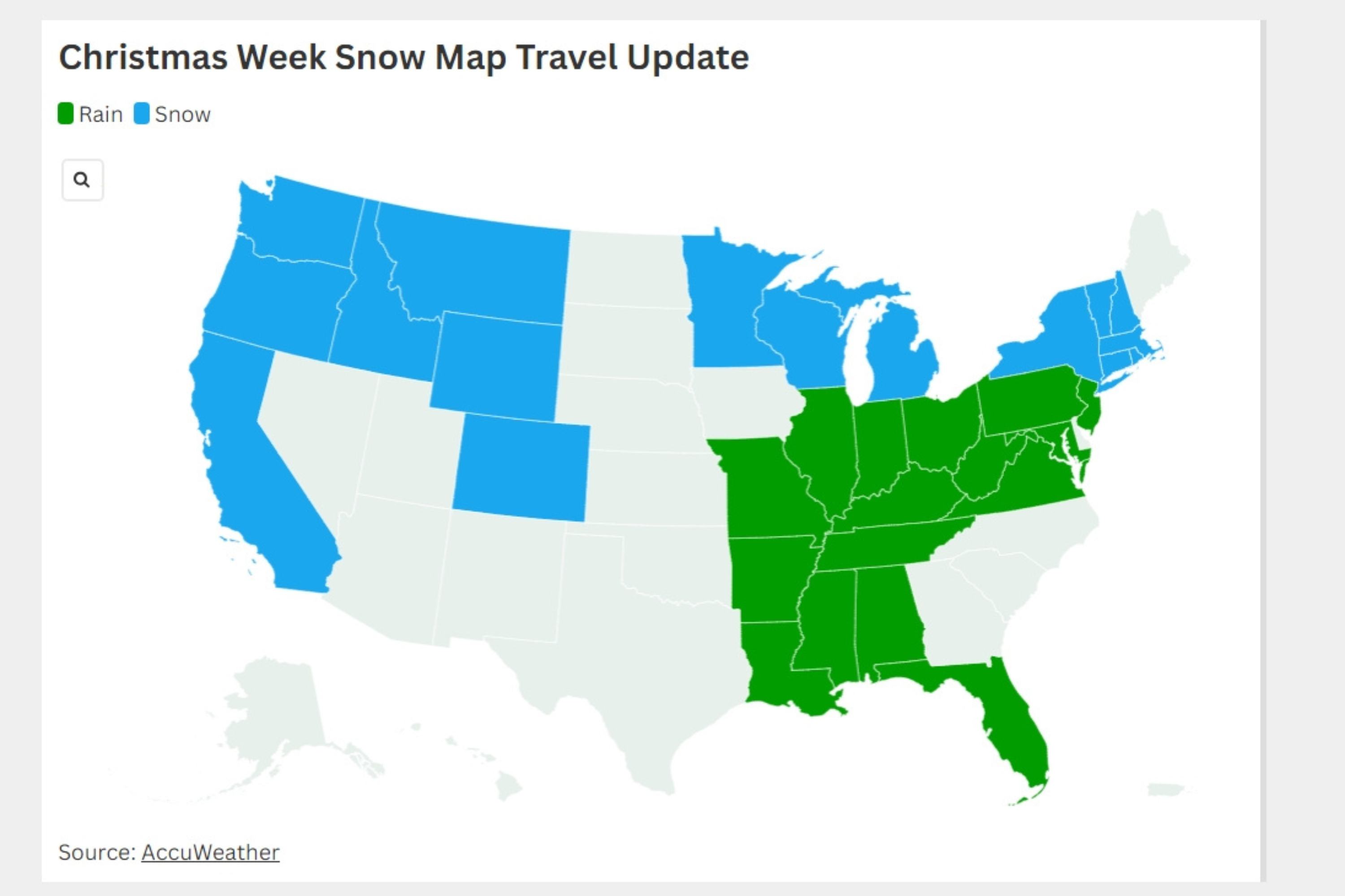
Recent forecasts show that rain will hit much of the Midwest and southern U.S. during Christmas week. Snow, or a wintry mix, is expected in the Northeast, Great Lakes Region and the Pacific Northwest.
Widespread travel is expected to begin this weekend, and several storms are in place across the nation that could pose issues. An atmospheric river is expected in the Pacific Northwest, bringing heavy rain and mountain snow. Travel could be treacherous over the weekend and early next week as multiple atmospheric rivers take aim at the West Coast.
A fast-moving storm system in the Great Lakes region is expected to continue moving east, where it could possibly collide with an offshore storm, bringing more travel issues across the heavily populated Northeast.
What People Are Saying
AccuWeather senior meteorologist Alex Sosnowski told Newsweek: “The Alberta clipper moving across the northern U.S. on Thursday will bring snow to the Northeast this weekend. However, there’s the chance that an ‘energy transfer’ from the clipper will transfer to an offshore storm system in the Atlantic Ocean, pulling that system closer to the East Coast and unleashing winter weather that could create hazardous travel conditions along the Interstate 95 corridor, which travels through populous cities including New York City and Boston.”
AccuWeather long-range expert Paul Pastelok, in a report: “One [West Coast] storm will move through the area on Saturday with some rain and mountain snow. A stronger storm will follow early next week, before the Christmas holiday, with heavy rain, heavy mountain snow and wind, which can extend into Northern and Central California. A third storm will follow from later Christmas Day into December 26.
“When it comes to the Northeast, a separate winter storm could disrupt travel. A weak storm is likely to move quickly eastward from the Great Lakes and Ohio Valley during the day on December 24 and then through the central Appalachians, the mid-Atlantic and New England from the evening hours on December 24 to early on Christmas Day. This storm will bring mostly rain but can bring some mixed frozen precipitation, especially over the northern tier and central Appalachians, where a wedge of cold air is most likely to linger.”
What Happens Next
National Weather Service offices across the nation will issue alerts as needed, and people are urged to stay up to date with the forecast before they travel, before and after the holiday.


